Homestake Valley · Colorado
See the place at stake.
See how the different Whitney reservoir options would change the valley. Compare them, adjust the water level, and explore the land that would be flooded.
Loading Whitney D…
View historical maps and explanationMap layers
Whitney Lake Trail is always visible in pink. The gold line is the existing Homestake Road.
Map key and details
Water level adjusts modeled pool height; storage is recalculated separately.
- Water: light = shallow, dark = deeper
- Modeled earth-and-rock dam
- 2019 wilderness boundary-change concept
- 13 proposed test-bore sites (A1-A5, B1-B2, C1, D1-D5)
- Existing Homestake Road / FSR 703
- Whitney Lake Trail / #2002
- Location reference points
Gold numbered pins: 1 Whitney Creek Trailhead approach; 2 and 3 Lone Rock Fen roadside approaches. Use Homestake Road and public land; respect private parcels and posted boundaries.
Habitat: CNHP wetlands and potential fens. Ownership: Eagle County parcels. Blue dot and ring: your GPS position and reported accuracy when Locate is on.
Red dots locate the 13 drilling sites proposed in the 2019 application.
The wilderness outline reproduces Aurora Water's 2019 combined Whitney and Blodgett boundary-change concept, up to 497 acres. Toggle it in Layers to see them together.
Switching reservoir variants or choosing Terrain keeps the current camera view. Select the active reservoir button again to recenter looking up valley. The bright pink line marks Whitney Lake Trail. Drag horizontally to orbit; use two fingers to pan or zoom. In full screen, drag in any direction to orbit. A vertical swipe scrolls the page in the embedded view. Use the buttons on a keyboard. Pause 3D releases all map gestures.
Sources and context
Existing Homestake Road and Whitney Lake Trail come from USGS and Forest Service mapping. The trailhead marks the roadside start of Whitney Lake Trail #2002.
Potential road relocation
Historical reporting places the potential Homestake Road relocation on the wilderness side of the valley; its alignment remained undecided in July 2026.
How this model was made
The model traces dam locations from Aurora Water’s 2019 draft map and places them on USGS 3DEP 10 m bare-earth terrain at 1× scale. A connected-pool solver fills low ground behind a modeled earth-and-rock embankment and calculates storage from area and depth. Display limits are B 6,850, C 10,000, A 15,000, and D 20,000 acre-feet, within the utilities’ published 6,850–20,000 acre-foot range. Investigation points come from the 2019 drilling application.
10 m terrain: USGS 3DEP. Satellite / aerial: USDA and USGS The National Map; the sharper Whitney-area texture is 0.6 m source NAIP acquired September 22, 2019. Topo: USGS. Concept map: Aurora Water, 2019 draft. Lakes: USGS GNIS. Existing road, trail and trailhead: USGS / Forest Service mapping.
Whitney D starts at its modeled full pool of 19,970 acre-feet.
The terrain loads automatically. Open the explorer for full-screen controls.
The source concept maps
Aurora Water's historical Whitney B, Whitney D, and wilderness-boundary illustrations, shown as published.
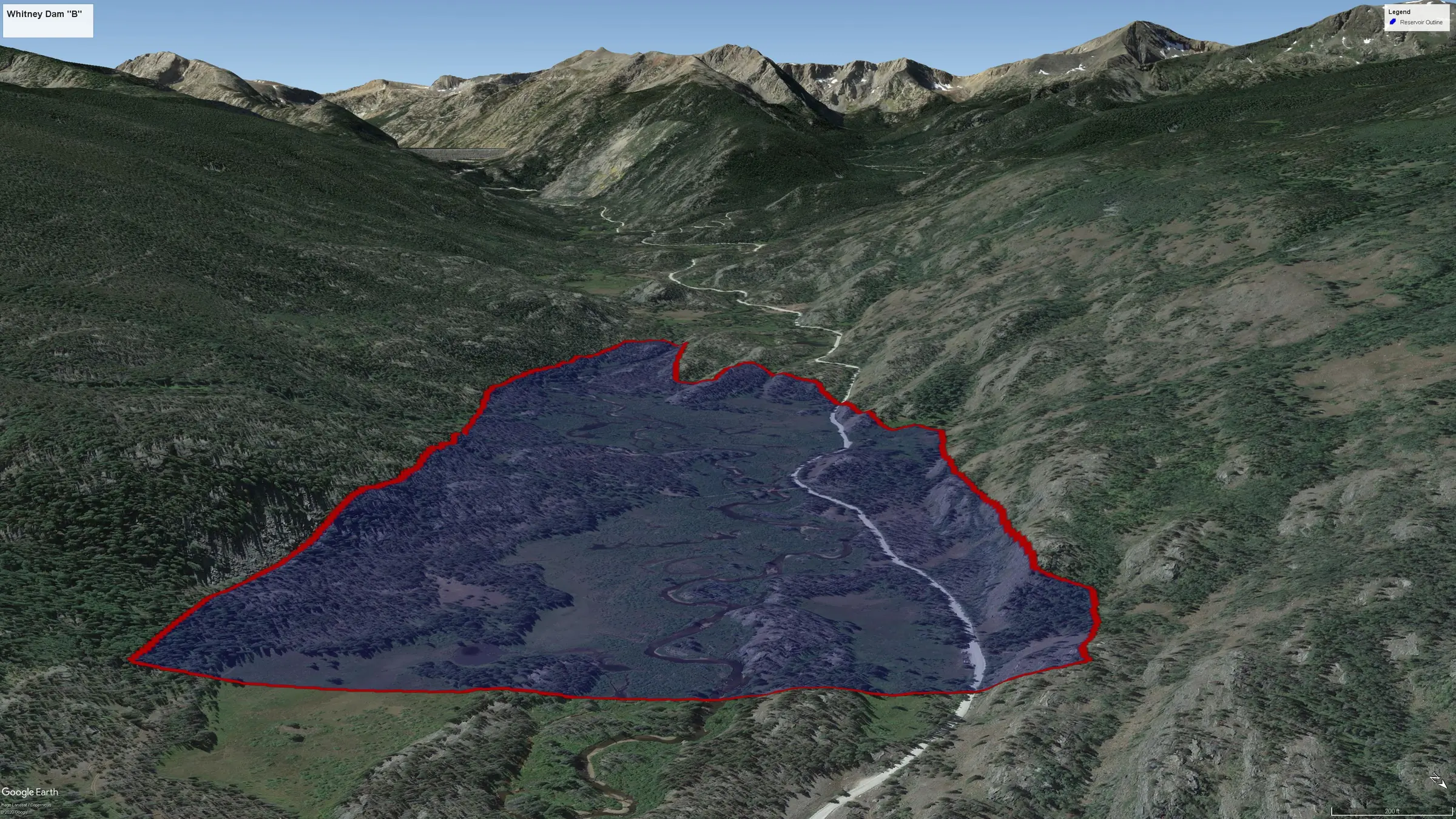
Explore what Whitney Reservoir would change.
Compare one reservoir variant at a time, adjust the water level, and watch the shoreline follow the valley.
Read what is proposed